Monday, July 1, 2013

Days 38 and 39 – June 26 and 27 California Lava Beds and Volcanic Peaks


(Because of time, I'm simply posting all the pictures - and there are a lot - at the end of the post. I'll arrange them appropriately when I'm back from the John Muir Trail.)

I woke up to the sound of rain. Ah, something new and different. Well, it was different in that it quit before I got up and I haven’t seen any since thankfully. I also woke up to a calm lake with herons roosting on the far side. Occasionally one would rise and glide above the water, only to find a little more desirable place to settle into preening and whatever else herons do. It was sunny by the time I broke camp, and I was eager to get on the road to California

After looking at the map, I decided to follow Eric’s advice and take the less populated road.  I noticed one route I could take ran by Lava Beds National Monument, so I programmed the GPS and headed into California.

I don’t know what it is about northern California, and maybe the feeling was enhanced by the strengthening sunshine after so many days of clouds and rain, but I almost always feel as if I’m coming home when I’m there. And this day was no different. It seemed I could breathe more deeply and a sense of ease came over me. I was driving through smallish mountains formed by 
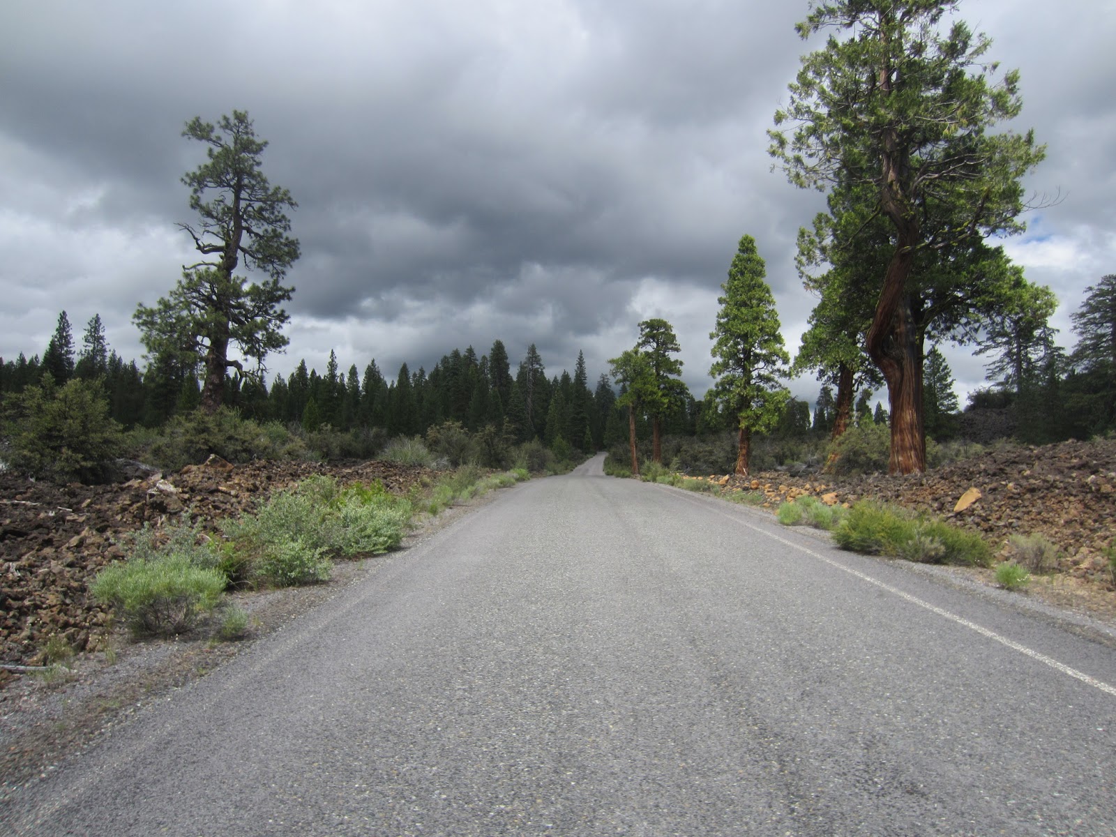
volcanic activity, and as I approached Lava Beds, I began to see more and more evidence of volcanic activity. Beds of black porous rock lined the highway, and the mountains became more distinctly volcanic, even to a layperson’s eye like mine.

Lava Beds National Monument was such an unexpected pleasure. I kept stopping the car to shoot pictures, but I still was unable to capture the magnificence of the landscape. When I pulled up to the entrance gate, I visited for a few minutes with the ranger there, asking what I shouldn’t miss. Wonderfully friendly and helpful, she said I should hike to the fire tower at Schonchin Butte and suggested I hike into Skull Cave, the deepest cave open to the public at the time.

Thanking her, I headed for the butte. I first saw the fire tower atop the butte, and then I saw the turn off. She had warned that it was a short but steep hike, climbing 500 feet in .7 miles. I figured it would be good practice for the John Muir (which climbs 5000 feet in the first 13 miles) and was looking forward to the hike and stretching my legs again after a few days primarily in the car.

As I was climbing to the tower, the smell of the cedar trees was strong and the air crisp. I was overcome with pleasure as I realized, once again, that this is why I hike. The pleasure and joy I get from the immersion in the purity of all the earth has to offer our five senses cannot be overstated. It feeds my soul as little else does. When I’m tuned into taking it in, there’s a feeling of oneness and belonging I feel nowhere else.

As I rounded the side of the butte, coming around to the north side, the wind hit me, and it strengthened the rest of the way up. The departing storm system was to the north, and the sky was dark there. In places I could still see the rain coming down. I wondered if I should have brought a jacket (“a three-hour tour . . .”) and my backpack. But I arrived at the top without mishap, and the ranger stationed there greeted me warmly. It turned out his wife was the ranger at the entrance, and he was just as friendly and helpful as she had been. I was the only visitor there, and we had a nice chat. I then made the trip around the building, taking in the entire surrounding landscape, seeing the evidence of spent volcanos and the contours and layers of the land.

The hike back down was quick, and I made for Skull Cave. Arriving there, I had a strong feeling of foreboding.  The idea of a cave seemed eerie and more than a little frightening, and the topic of bats had been talked about by both rangers. The yawning opening of Skull cave was not tremendously welcoming, but the path was well-constructed, and there was a man with his two kids going in just behind me. I couldn’t exactly chicken out when a 10-year-old girl was eagerly anticipating exploring the cave. (The younger boy did end up going back to the car to sit with his mother after walking a few feet into the swallowing darkness.)

The cave is an ice cave, meaning the floor is made of ice and rock. This is an important source of water for the animals of the region, and the park management had actually blocked off the floor to protect the ice from foot traffic. To get to the lowest level accessible, I had to descend a number of very steep metal staircases. I thought once again what good fortune it is that I’m over my fear of heights. I could have never made that descent and subsequent ascent if I were still acrophobic.  My little headlight and keychain MagLight were no match for the deep darkness of the bottom of the cave, so I saw very little outside a small area. I didn’t linger long, and I doubt I’ll do much spelunking in the future, but I was very glad to have seen the cave – and no bats.

I drove south out of the park, taking the volcanic parkway scenic drive. The road was very rough and narrow, but again, the views were wonderful. It was really interesting to see so much of the land altered by volcanic activity. The drive took me down to Lassen Volcanic National Park where Lassen Peak, the southernmost high peak of the Cascade Mountain Range, rises. Eric had explained to me that the Cascades, which end around Lassen Peak, are all volcanic, and that the Sierra Nevada, which begin their run south near the same spot, are granite and upward thrust mountains. (Forgive me for not knowing the proper term here).

Lassen Peak rises out of the surrounding mountains pretty obviously, and I was surprised about the amount of snow on it. I decided to camp there in the park’s campground, knowing I could shower there and have running water. I settled down for the night, built a rather weak fire – everything was still damp – and retired to my tent fairly early. I didn’t sleep well though – it was cold and damp and I was feeling lonely.

It seems I feel more lonely when I stay at large campgrounds where everyone around me is camping with family and loved ones. I feel rather isolated as I can’t help but observe the interaction among the campers. I had debated about staying two nights at Lassen, but I decided to move on the next day, after maybe a short hike and driving through the park. I yearned for one of my inexpensive, primitive campgrounds.

The next morning, after a much-needed shower, I began driving the one road through the park. I had planned on maybe hiking King’s Falls Creek, but for some reason, it just didn’t feel like the hike for me. Eric had suggested I hike to the top of Lassen Peak at just over 10,000 feet, but the ranger at Lava Beds told me they only allow hikers to summit the peak a few days of the month in June and July, and I wasn’t there one of those days. So I had given up on that idea, and was just basically looking for what looked like a good hike.

When I got to the parking area for Lassen Peak, I pulled in to check it out. After reading the information posted, it was clear that although I couldn’t hike to the peak, I could hike up a little over a mile toward the peak. The trail was closed after 1.3 miles, but I could hike to there. It was a steep climb, but I was excited to do it.

Lassen Peak, by the way, is a volcano that blew in the early 1900s. It blew twice, a few days apart. The destruction zone is large, and the evidence of the volcano’s power is still evident.

The trail led up steeply, and then began making switchbacks as it climbed. There was a good deal of snow on the mountain, and some of the trail was still snow-covered. There were also some downed trees that I had to navigate around, but it was still an invigorating hike.  I was stopped about a mile up, talking with a couple from southern California, when park workers began passing us, carrying all sorts of surveying and other equipment. They were doing some extensive trail maintenance and had been for a few days they said.

About the third group that passed us stopped just as they went around. One of the crew exclaimed as he sat on a rock outcropping and pulled off his boot. Blood dripped from the top of it, and his sock was saturated. He dumped blood out of the boot, and it continued to drip from his sock. The other crew member with him began to administer first aid. It was horrific. The injured man said he’d had a blister the day before, but it didn’t seem too bad. If this was a blister that was neglected and ignored, it certainly has driven home the importance of not doing so.

I asked if I could do anything, and the one asked if I would go back down the mountain and tell the crew members who were on their way up. They were bringing up a motorized wagon and would be able to help the man down - he wasn’t coming down without assistance. So I cut the hike short, but I figured helping with the situation was more important than hiking that last third of a mile to the turnaround point.

I still don’t know what happened or how long it took the man to get down, but I’ve thought a lot about him and his bleeding foot since leaving Lassen Peak.

I left Lassen Park and headed east toward the Sierra Nevada. I always enjoy driving 395, the highway that cuts across northeastern California and then down through Reno and Lake Tahoe, and finally running along the east side of the Sierra Nevada. The first part of the drive, as it cuts mainly east, is wide open high desert. I can’t drive that portion without thinking of the time Jesse and I came across there late at night and stopped for a while to look at the night sky, arguing over whether the star near the moon was Jupiter or not. After checking Google Sky, I was proved correct – it was Jupiter. But the night was so dark and the stars were so bright, it didn’t matter who was right or who was wrong. What mattered was the brilliance of a sky full of stars and little else in the way of light.

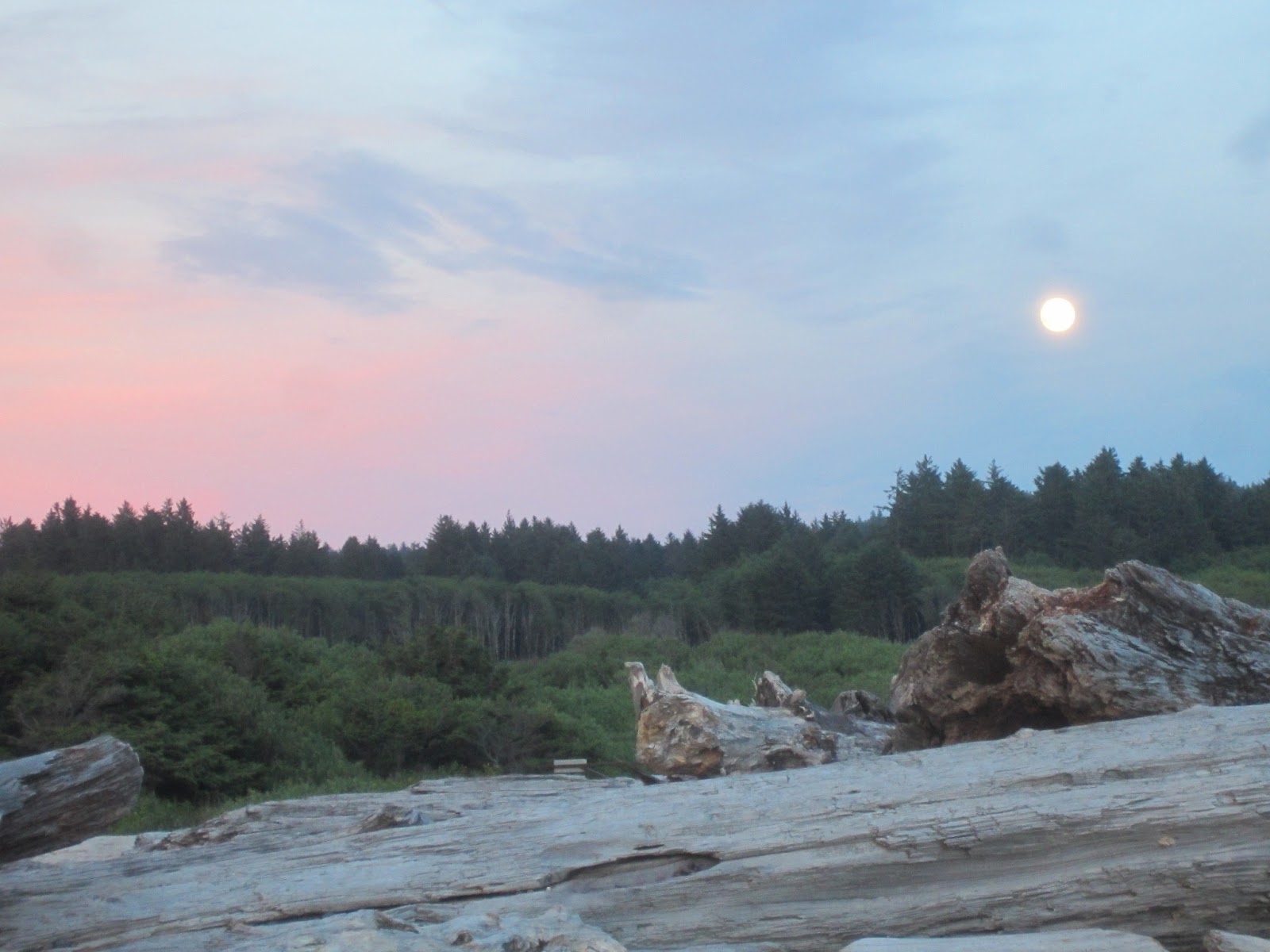
But this drive was in daylight, and I admired the landscape as it changed along the way. I found Lover’s Leap campground southwest of Tahoe in a little burg named Strawberry.  I settled into the primitive campground and thought about the upcoming hike through the Sierras, feeling anxious and worried about my foot. The undertaking seemed unmanageable that night – all of my doubts and fears wore large and frightening shapes, and I had another night of little sleep. I hoped I would have some direction the next day, and finally fell into a restless sleep.  


Saturday, June 29, 2013

Days 36 and 37 – June 24 and 25 Oregon Beaches, Forests, Hot Springs and Lakes – and Rain


Roadside view

It was raining when I woke up on the coast in Oregon, but by the time I’d showered and dressed, the sky had cleared just a little. I broke down camp quickly, before the rain had a chance to start up again, and I headed inland.


This was a driving day, and I was indecisive about exactly where to go and which routes to take to get there. All I knew is that I needed to head south eventually. I inquired at a forestry office about trails, but their area didn’t include the places I was interested in hiking. I wasn’t sure if I even wanted to hike in Oregon, as I’d begun itching to get into California.

I drove south in a non-linear way, following various scenic highways. It was still raining, and I didn’t look forward to setting up in the rain. I remembered there was another  “clothing optional” campground near Eugene, so I decided to check it out. I knew it had a hot tub and a pool, and the camping fee was $10, so I couldn’t really go wrong. I still felt really indecisive about where to go, so I decided I might as well go there.

I got to the Willamettans around 7 p.m., and it was still raining. I found a campsite and set up quickly. Once I was set up, I went to the pool and hot tub. The pool was wonderful. Although it was cool and sprinkling, the water was warm, and I floated around for a while. There was a man there swimming laps, and we visited. He told me of a natural hot springs not too far from where we were, and it happened to be on the road heading south. He told me it was called Terwillinger Hot Springs, and that settled it for me. One of my favorite essays, by Annie Dillard, is called “Terwillinger Bunts One.” I took this as a sign. Plus it was really nice to have a specific destination in mind.

 I finished the evening with some time in the hot tub. There I met a man who is an arborist, and we got into a big discussion about the differences between the Sequoias in the Sierra Nevada and the Coastal Redwoods. He was a fascinating man and I enjoyed our talk. I didn’t linger long there – I was tired and wanted to get back to my tent, fix some dinner, and get in out of the rain.

It rained all night, and it didn’t quit for me to break camp this time. I was able to break down the tent under the rainfly – quite a feat if I do say so myself – and keep from getting everything too wet. I pulled out the big golf umbrella I carry and hauled everything back to the car under that. I also used it to shield the open places in the tent from the rain. Again, I had to put everything in the car wet. I have to say, I was getting pretty tired of the rain.


I knew I was heading for the hot springs – colloquially called Cougar Hot Springs for those unable to get their tongues around Terwillinger – so I wasted no time. I found it on the map, and it was only an hour or so away. The drive to the hot springs was on a forestry highway, and the view, as the road ran along a deep canyon carved by a fast-running river, was spectacular. I finally came upon a little sign declaring I’d found the hot springs. The springs cost $6 to use, and the forestry service operates them. The man working the admittance station was certain to inform me that these springs were “clothing optional” so I wouldn’t be put off by what I might see there. I assured him I intended to exercise the option.

The walk down to the hot springs was about a third of a mile long. It passed a lovely waterfall and then wound through what appeared to me to be a rainforest; the trees dripped with moss and ferns lined the way. The path was well developed, and apparently this spot is well-frequented.


When I got to the hot springs, there were two young couples there, all in bathing suits. With my new-found freedom, after saying hello to them, I disrobed completely and entered the middle of the five pools.

The pools ranged in temperature from just over 100 degrees at the hottest one to rather cool water in the coldest. The attendant had suggested I start in the middle, which was like bath water. The people there were all in the second-warmest, so I went to the empty middle pool.

After the dip
The pools were formed with smooth rocks that were easy to navigate and at all different levels and depths. There were a variety of places to sit and I fully emerged myself. It was quite an experience. I’ve always been a little tentative in natural water, and here I was completely naked – I couldn’t help but worry about my unprotected lady parts. I figured others did it with no ill effects, so I should be able to too.  I was right.  It was wonderful.

As soon as the couples moved out of the warmer pool, I moved up. They left after a while, and I was completely alone. It was heavenly. After sitting in the fourth pool for a while, I moved up to try the hottest one. It was also nice, but I couldn’t stay there as long and moved back down to the fourth pool. It was there I was sitting when the next person arrived.

Gary, as I came to know, was a wonderful gentleman in his sixties. He disrobed and climbed into the pool with me. After our initial pleasantries, he asked how long I’d been a nudist. I laughed and said,
“oh about two weeks.” We sat and talked for probably close to an hour, and I really enjoyed our conversation. As we visited, another couple came down.  They were in their early thirties, and while he disrobed completely, she wore a little swimsuit cover and covered her bare breasts with her hands every time she was out of the water.

Gary, who is a third-generation nudist, told her to relax and just let it go, but she couldn’t quite do it. I admired her tattoos and we talked a little about each of ours. They left just before I did, so we were dressing at the same time. While I was giving Gary my contact information, she overheard and said her last name had been Erickson too. They headed up the trail as Gary and I finished talking, so I was surprised when I emerged from the trail and saw the two of them – Melisa and her husband Jesse – walking back toward the trail.

I asked them if they were going back for more, and Melisa said, no, they were coming for me. I looked surprised I’m sure, and she told me she’d locked her keys in her car. I ended up giving her a ride to cell service, and we got to know each other on the ride down and back. She’s a lovely young woman, and we are now Facebook friends. I love the connections I’m making here on the road.
 
After getting them situated, I headed south down the forestry road and wound through tall trees, over mountains, and alongside rivers. These small, back country roads are the most enjoyable driving I’ve done. There’s something every mile it seems to look at and appreciate. One of the most memorable moments was when I noticed something, some small animal, struggling along the road up ahead. I slowed and saw it was a brand-spanking new faun, barely able to walk yet. I was witnessing it getting its legs for the first time and scampering, a little wobbly, into the trees. I never saw the mother, but she must have been close by. I was only sorry I didn’t have time to take a picture.
 
My journey south would take me near Crater Lake, so I decided I needed to drive by it again this year. It never occurred to me that it’s more than a month earlier than I was there last year, and that it would be quite different. I had read on Facebook a few weeks earlier that they had just opened the North Rim road, and this opening was earlier than usual, but I never put the two things together. I realized why when I approached the rim of the lake.

I saw snow up ahead, and was surprised. I hadn’t seen snow since I’d passed Mount Rainier from the highway, and a little on the high peaks in Olympic, and I didn’t think I would see it at Crater Lake. But not only did I see it up ahead, I drove through it. The road was bordered by snow almost the entire way, and some of the drifts were still ten feet or more high. It was surreal and ghostly not only because of the deep snow, but also because it was raining and foggy and cold.

The lake is barely visible through the fog
When I drove the Rim Road last year, I remember it being harrowing because it is such a narrow road and there are steep drop-offs with no guard rail. Imagine that being exacerbated by the rain and fog. The temperature was about 40 degrees; I’d entered a whole different environment. But still, the lake calls to me. There’s something about Crater Lake that defies explanation. As my friend Marcella calls it – primordial. It was as compelling as it was harrowing – and I was through the drive much sooner than I’d anticipated. With the fog, I’d lost all sense of distance, and before I knew it, I was headed down below the rim again. The rim is at about 7500 feet elevation, and at the base it is about 3000 feet I believe, where there’s no snow and it was 20 degrees warmer.  I could almost do the drive again. Almost.

I decided I wanted to camp a little farther south – both to be farther on my way and to find warmer temperatures. I looked at the map and saw a couple BLM campgrounds outside Klamath Falls. I headed there, not knowing what I’d find. I passed through the small, kind of dirty town of Keno, Oregon, and I wondered what the campground would be like, feeling a little apprehensive about my safety. I was awfully near civilization, and that felt less safe for some reason. I drove along, watching along the side of the road for signs of the campground. I finally saw a sign for Topsy Recreation Area and saw the familiar triangular tent symbol. 
Driving in this with the fog, rain, and drop offs is not relaxing

I drove up the winding dirt road till I came to the campground. I need not have worried. (When will I learn that?) It was a lovely little campground on the edge of a lake, and the camp hosts, an elderly couple originally from Iowa, assured me there was plenty of room and that they locked the gates at 9 p.m. and unlocked them at 6 a.m. for security purposes. It sounded perfect.

The far side of Crater Lake - no snow to be seen
I chose a campsite right on the lake. As I was looking at it, a heron flew by, skimming the water. The only other camper was a man, Eric, from about three hours south, as he put it. He was out on his bike, scouting a route for a motorcycle ride later this summer, and taking some time for his “therapy” – camping alone. We talked for a little while, and he suggested I hike at Lassen Volcanic National Park. He explained how to get there to avoid the truck route, and my agenda was set for the next day.

I enjoyed the star-filled sky for a while, lost the battle to start a fire with my inferior wood, and retired for the night, grateful for the first night in a while without rain.


Thursday, June 27, 2013

Days 34 and 35 – June 22 and 23 Olympic National Park


Cruise ships and Canada


The glorious weather brought out the clam hunters


I left Sally’s house early. I wanted to get down to the Lacey, Washington ShopKo to pick up my foot support. I am really fortunate that I have Jesse as a friend, who was willing to spend the time and effort to find things like this for me. It took a few hours and a number of phone calls, but he was able to find the only Slimline Ankle Brace, apparently, in the whole Northwest.


Cape Flattery
Looking down at the most northwest point in the U.S.
I picked up the brace and looped back up the interior drive of the Olympic Peninsula. What a glorious drive it was. It was the first day in quite a few that it was sunny and warm, so I took my time and wound up and around to Olympic National Park. When I got to the northern visitor center, I talked briefly with a ranger, a young woman, who was not much help in the way of suggestions for hikes or areas not to miss.

Looking out from Cape Flattery
Tara, my new friend from LARC, had suggested that I not miss the Hoh Rainforest, so that was high on my list. The rainforest, though, was completely around the park, and I wanted to find something to do before it started cooling off and getting dark. I looked the map over, and realized I didn’t want to miss an opportunity to hike to the most northwestern corner of the contiguous United States - Cape Flattery. The point is near Neah Bay, and both are part of the Makah Indian Reservation. The drive borders the Strait of Juan de Fuca, the body of water that separates the U.S. and Canada, and is beautiful. I saw fishing boats and cruise ships in the strait, and the mountains of Canada ran all along the shore.
 
The hike to the cape was only about three-quarters of a mile long, and was well-built with boardwalks and bridges. Apparently this trail is fairly new, and the previous trail was much less walkable. There were a number of people on the trail and at the point, but it didn’t detract from the view of this northern end of the Pacific Coast. The views were breathtaking, and I walked down around the viewing platform to stand right on the edge of the cliff. I couldn’t have gotten farther northwest without getting wet.

Once I was back on the road, I headed south. It was getting a little late, and there was rain forecast for the evening, so I decided, by looking at the map, to camp at Mora Campground on the coast and save the rainforest for the next morning. What an intuitive decision – it was one of the best I’ve made so far on the trip.

I arrived at Mora and quickly set up camp. The campgrounds were just less than two miles from the beach, and I wanted to see the sun set over the water. It was also the night of the Supermoon (well actually it was the night before, but I knew the chances of it being clear the next night were slim to none), and I wanted to see it come up from the beach too.

The beach was lovely. There was a big garden of driftwood – for lack of a better term – that I needed to walk through before getting to the open sand, and the shapes and textures were compelling. But the ocean. There is nothing quite like the Pacific Ocean of the Northwest. The water was cold of course – too cold for swimming but not the dipping of toes – and watching the waves come in, crashing on the sand, is always mesmerizing. There were a few outlying islands, and they ended up being the perfect skyline for the setting sun.

There were clouds to the south, and the universe cooperated with providing some sort of invisible boundary that held them at bay. There were just a few that began encroaching on the sun, providing the multiple hues and textures for one of the most amazing sunsets I’ve ever seen. The sky kept shifting into deepening hues of oranges, pinks, and reds, and I snapped picture after picture trying to capture the magnificence of the sky.

And turning away from the setting sun, as it got close to the horizon, the full moon appeared in the opposite sky. Just above the treeline, it glowed large for a while before the high clouds obscured it. I had gotten my sunset and moonrise, and, after taking a few more pictures, it was time to head back to camp.

Once back at camp, I attempted to make a fire, but the wood I had bought was damp or green, and building a fire in a damp fire ring with un-aged and damp wood is beyond my skill level. I fought it for a while and had a bit of a blaze, but not enough to cook over. Little did I know that that would be the last successful campfire I would have for a number of days.

It did rain that night and again in the morning, but the rain was light and I was under a canopy of trees. I don’t mind rain once I have the tent set up, but trying to set up or take down a tent in the rain is about the least amount of fun one can imagine. I was lucky that the rain was spotty that morning and I was able to break the tent down without much trouble. I also figured a way to put the wet rainfly in the back of the car without spreading the moisture everywhere.


I drove to the rainforest, and appropriately, it continued raining. The drive was lovely, and I stopped occasionally to snap some pictures. Once at the rainforest, I decided to hike two of the park’s short interpretive trails, and it took me quite a while as I enjoyed the information and the lush, wonderful landscape. I visited with a mother and son who were here from Canada and Great Britain respectively, and we hike a little of the way together. The rain was light, and my rain jacket and hat were plenty for keeping me comfortable.
 
After the rainforest, I continued south to Oregon. To cross into Oregon, I took the four-mile long bridge that runs into Astoria. It was raining, but the experience was still stunning as I drove what seemed for ages over water. Once into Oregon, I headed for the first campground that appeared to be right on the beach.

Oregon Coast

4-mile long bridge going into Astoria, OR
Steamers!
I found Nehalem Bay State Park, and the ranger there helped me pick a nice campsite just over the dunes from the beach. Again, I was able to set up during a brief break in the rain, which was a nice little bonus. I decided to find somewhere to eat steamed clams (I’d had some fish from a roadside stand earlier) and drove back up the coast a few miles to one of the few places open after 9 p.m. I spent more money than I should have, but two pounds of fresh steamers is worth a bit of sacrifice. I knew I was heading inland in the morning, so it was my last chance for fresh coastal seafood.  Until next time, that is.