|
| Horseshoe Bend in Glen Canyon |
June 4 – Waking up on Arizona time is kind of a shock. The sun
pushed through the thin walls of my tent, prying my eyes open before the alarm.
I had decided to stay another night and needed to pay before heading out for my
hikes in the morning, so I planned to get up by 6:30. When I checked my phone
for the time, it was a little after five and the sun was full up.

Since Arizona has taken a moral
objection to Daylight Savings time, everything is off-kilter here. This is
exacerbated by the fact that we’re right on the border, so if a person drives a
little way on Highway 89, she enters Utah and it’s an hour later. I’ve noticed
some businesses on the 89 corridor have clocks that state both times. My cell
phone couldn’t seem to decide which cell tower to pull from either, and the
second morning at the campsite, my alarm went off twice – at 5:30 a.m. Utah
time and 5:30 a.m. Arizona time.
But this morning, my phone only
registered Arizona time, and so my timing was right to be dressed and ready to
go when the campground office opened at 7 a.m. After paying for the second night,
I set off to do a number of small hikes in the area, and to visit the BLM
office near Kanab for trail information. This is the same office where Jesse
and I secured our Wave permit, so I was eager to revisit it. I also knew they
had a lot of information about area hikes, specifically Buckskin Gulch, one
I’ve been interested in since we hiked the Wave in 2011.
 Knowing the temperature would reach
into the 90s, I decided to hike first and talk later. After a few stops in town
for coffee, ice, and water, I drove out to Horseshoe Bend. Just outside of
Page, Arizona, this is a short hike, only a mile and a half long. Much of the
hike is on sandy ground and it has some elevation gain in that short distance,
but it’s not what I would call a strenuous hike. And therein lies the issue.
Knowing the temperature would reach
into the 90s, I decided to hike first and talk later. After a few stops in town
for coffee, ice, and water, I drove out to Horseshoe Bend. Just outside of
Page, Arizona, this is a short hike, only a mile and a half long. Much of the
hike is on sandy ground and it has some elevation gain in that short distance,
but it’s not what I would call a strenuous hike. And therein lies the issue.
I knew I was in for a crowd when a
tour bus turned in just before I did. Sure enough, a whole load of Asian
tourists poured out, and I knew I’d have to create my own mental space to enjoy
the hike and the view. I mention that they are Asian because it amazes me, when
I’m traveling in the west like this, how many of the tourists I run into are
Asian or European. Sometimes they are Australian or South American too, but
very few are American. The people who took my picture here were a father and
daughter from Norway, and the ones who took my picture later in the day at the
Hanging Gardens were a mother and son from Great Britain (however she was from
Argentina originally). It is so
interesting to talk to these people and to hear briefly about their travels.
 So I joined the crowd and hiked out
to the rim of this beautiful Glen Canyon to see the Colorado meandering along,
deceptively gentle in its flow at this point. The river was always slower
through Glen Canyon, even before the dam was built, with this calm stretch
between the famous rapids of Cataract Canyon and the Grand Canyon. That is one
of the reasons planners thought it was a good idea to dam it here. When you see the depth and beauty of this
canyon, it brings home the tradeoff that was made between destroying a good
part of one of the greatest geological formations on earth and supplying water
to a growing, greedy population of humans. No easy answers are to be found here
– human needs of course are important, but so are the needs of the earth. This
seems to be one of the paramount questions of our time with the Earth’s
exploding population and our dwindling resources and wild places. I certainly
can offer no answers. I just know it breaks my heart to see what we humans are
doing to the planet that is irreparable. Maybe we could get along with fewer
golf courses in the desert and fewer conveniences like disposable water bottles
and a new outfit for every day.
So I joined the crowd and hiked out
to the rim of this beautiful Glen Canyon to see the Colorado meandering along,
deceptively gentle in its flow at this point. The river was always slower
through Glen Canyon, even before the dam was built, with this calm stretch
between the famous rapids of Cataract Canyon and the Grand Canyon. That is one
of the reasons planners thought it was a good idea to dam it here. When you see the depth and beauty of this
canyon, it brings home the tradeoff that was made between destroying a good
part of one of the greatest geological formations on earth and supplying water
to a growing, greedy population of humans. No easy answers are to be found here
– human needs of course are important, but so are the needs of the earth. This
seems to be one of the paramount questions of our time with the Earth’s
exploding population and our dwindling resources and wild places. I certainly
can offer no answers. I just know it breaks my heart to see what we humans are
doing to the planet that is irreparable. Maybe we could get along with fewer
golf courses in the desert and fewer conveniences like disposable water bottles
and a new outfit for every day.
After this short hike I headed for
the BLM office for more hiking ideas. The drive runs for a while along Lake
Powell, the result of the canyons and tributaries flooded by the Glen Canyon
Dam. Water levels have dropped from their
highest point years ago, and the regression of the water level is evidenced in
the white mineral deposits left by the flood water on the re-exposed rocks. I
was told that the water is down around 35 meters from its highest point, less
than half full, and it is doubtful it’ll ever rise again to its full level. The
town of Big Water is not on the water any more, and what looked once to be a
marina is now just boat storage.
 Past the drying lake, the terrain
changes to red cliffs and mountains. It is there that the BLM office is
located. I had no problem finding it – I
remember exactly how it sits on the land and how the approach looks. When we
were here before, it was my first hike ever, and it changed my life. The people
working in there this year were just as helpful as the ones three years ago,
and they gave me great advice for the next day’s hike at Buckskin Gulch. We
talked some about how dangerous this part of the world is to hike in,
discussing the three people who died last year hiking the Wave and the one who
died a little farther north hiking to some slot canyons in Escalante National
Monument. I have hiked both those routes, and know how confusing it can be
trying to find the trail. I’m so glad I have learned more about reading
compasses and maps and I have a good GPS.
Past the drying lake, the terrain
changes to red cliffs and mountains. It is there that the BLM office is
located. I had no problem finding it – I
remember exactly how it sits on the land and how the approach looks. When we
were here before, it was my first hike ever, and it changed my life. The people
working in there this year were just as helpful as the ones three years ago,
and they gave me great advice for the next day’s hike at Buckskin Gulch. We
talked some about how dangerous this part of the world is to hike in,
discussing the three people who died last year hiking the Wave and the one who
died a little farther north hiking to some slot canyons in Escalante National
Monument. I have hiked both those routes, and know how confusing it can be
trying to find the trail. I’m so glad I have learned more about reading
compasses and maps and I have a good GPS. The ranger
told me there’s already been a guy this year who had to be rescued from the
Wave hike. He obtained his permit illegally – a friend of his had gotten the
permit and couldn’t make the hike so gave it to him. The guy, of course, didn’t
get the instructions hikers are given when they get the permit, and he took off
unaware of some of the confusing elements of the hike. The rangers saw his car
in the parking lot for the trailhead, but had no idea of who he was or what
route he had taken since he didn’t have a legal permit. They searched for two
days before finally finding him. He had fallen off of an outcropping and was in
a bush, legs in the air, with ants crawling all over his face. The rescued him
and he survived, but what a horrifying experience it must have been. I keep
thinking of those ants . . .
The ranger
told me there’s already been a guy this year who had to be rescued from the
Wave hike. He obtained his permit illegally – a friend of his had gotten the
permit and couldn’t make the hike so gave it to him. The guy, of course, didn’t
get the instructions hikers are given when they get the permit, and he took off
unaware of some of the confusing elements of the hike. The rangers saw his car
in the parking lot for the trailhead, but had no idea of who he was or what
route he had taken since he didn’t have a legal permit. They searched for two
days before finally finding him. He had fallen off of an outcropping and was in
a bush, legs in the air, with ants crawling all over his face. The rescued him
and he survived, but what a horrifying experience it must have been. I keep
thinking of those ants . . .  I DO NOT intend
to be a cautionary tale rangers tell hikers, so I chose a route I felt safe to
take alone. A 24-year-old volunteer ranger had just come back from backpacking
a large loop that included the hike I wanted to do, so he suggested where to go
in (Wire Pass) and which route to follow for the best hike. His advice would
give me a six-miler, and that was just what I wanted. This gave me a game plan
for the following day, but his advice didn’t stop there.
I DO NOT intend
to be a cautionary tale rangers tell hikers, so I chose a route I felt safe to
take alone. A 24-year-old volunteer ranger had just come back from backpacking
a large loop that included the hike I wanted to do, so he suggested where to go
in (Wire Pass) and which route to follow for the best hike. His advice would
give me a six-miler, and that was just what I wanted. This gave me a game plan
for the following day, but his advice didn’t stop there.  I told them
I wanted to do another short hike this day, so he suggested another short mile
and a half hike – The Toadstools. By this time it was the hottest time of the
day. He suggested, to use time until it
cooled a bit, I drive up to the Paria (pronounced Pa-ree-uh) Township, a ghost
town and once the filming site of many western movies. He said the drive was
beautiful, so I decided, again, to follow his advice.
I told them
I wanted to do another short hike this day, so he suggested another short mile
and a half hike – The Toadstools. By this time it was the hottest time of the
day. He suggested, to use time until it
cooled a bit, I drive up to the Paria (pronounced Pa-ree-uh) Township, a ghost
town and once the filming site of many western movies. He said the drive was
beautiful, so I decided, again, to follow his advice.
It was a
beautiful drive. I stopped to eat lunch at the site, surrounded by cliffs of
various shades of reds, pinks, oranges, and grays. I had the world to myself,
and I tried to imagine living a life out there, threatened daily with heat and
Indian attacks. In fact, the town was abandoned in the 1800s because its
inhabitants couldn’t defend against the attacks. (Perhaps this is a good
example of karma and turn about being fair play.) But still, those people
worked hard to try to carve a life out of an unforgiving yet stunning
landscape, and they did succeed for a while.

 When I
squatted to take a picture, I had a sharp pain in my knee – a pain I’d noticed
when I got up in the morning. I decided to drive in to Kanab and see if I could
get in to see a chiropractor. In Kanab, after asking the advice from a local, I
visited one of the two chiropractors in town. He happened to be between
appointments and was familiar with the type of muscle or fascia release my
therapist in Sioux City does, and he worked me over. My knee was indeed out of
place, so he released my muscles and adjusted my knee. He gave me some
exercises to work on the muscles that had caused the problem, and it was much
better by the next morning. Funny how the universe gives us what we need when
we need it. And I was quite relieved it wasn’t some sort of tear.
When I
squatted to take a picture, I had a sharp pain in my knee – a pain I’d noticed
when I got up in the morning. I decided to drive in to Kanab and see if I could
get in to see a chiropractor. In Kanab, after asking the advice from a local, I
visited one of the two chiropractors in town. He happened to be between
appointments and was familiar with the type of muscle or fascia release my
therapist in Sioux City does, and he worked me over. My knee was indeed out of
place, so he released my muscles and adjusted my knee. He gave me some
exercises to work on the muscles that had caused the problem, and it was much
better by the next morning. Funny how the universe gives us what we need when
we need it. And I was quite relieved it wasn’t some sort of tear.
 I hiked two
more short hikes that day – the Toadstools and the Hanging Gardens. Both were
less than two miles each, and my total hike for the day gave me the five miles
I’m hoping to hike regularly as I develop my trail legs for the JMT. The
Toadstools are an easy, fun hike over some slick rock and along a few ledges,
and there I visited briefly with a family from Mexico, the only other people I
saw on the hike. I drove straight from that hike to the Hanging Gardens for a
ranger-guided short hike. There I enjoyed the ranger’s informative discussion
of the area, the canyon, the lake, and some of the geological features of the
land. I met the mother and son from Great Britain I mentioned earlier and was
fascinated to hear they were just winding up a six-month holiday. I thought I
took long holidays.
I hiked two
more short hikes that day – the Toadstools and the Hanging Gardens. Both were
less than two miles each, and my total hike for the day gave me the five miles
I’m hoping to hike regularly as I develop my trail legs for the JMT. The
Toadstools are an easy, fun hike over some slick rock and along a few ledges,
and there I visited briefly with a family from Mexico, the only other people I
saw on the hike. I drove straight from that hike to the Hanging Gardens for a
ranger-guided short hike. There I enjoyed the ranger’s informative discussion
of the area, the canyon, the lake, and some of the geological features of the
land. I met the mother and son from Great Britain I mentioned earlier and was
fascinated to hear they were just winding up a six-month holiday. I thought I
took long holidays.
Returning
to my tent, I showered quickly and bedded down early. I was set to get up early
the next day and tackle Buckskin Gulch.
 |
| The wash, before hitting the canyons |
June 5 – After waking up an hour
earlier than I’d intended thanks to my cell phone deciding to pick up Utah’s
tower at that moment, I packed up and headed for Buckskin Gulch.
 |
| Mostly lizards, but a few others |
I reached
the trail head around 8:30, and was on the trail a little before 9 a.m. Don’t
ask me why it took me so long to get there, I just took more time than I’d
planned breaking camp and stopping in town. So I knew the end of the hike would
be hot again, and I mentally prepared for it.
 It was a
beautiful morning. Still in the upper 60s when I began, the sun was bright but
not too hot yet. The trail was obvious and easy to follow; it basically
followed an obvious wash into the slot canyons. The only hardships were having
to first climb down some areas and then, on the return hike, climb back up
them. I’m glad the chiropractor had put my knee back in place – it would have
been extremely hard if I hadn’t been able to fully bend it. Climbing back up
was hard enough with fully functioning knees – I was glad no one was there to
see me ungracefully struggling up and over the rocks. It wasn’t pretty I’m sure
as I teetered on the edge of the rock, pulling my body up and over like an
ungainly turtle. But, I made it, and that’s all that matters.
It was a
beautiful morning. Still in the upper 60s when I began, the sun was bright but
not too hot yet. The trail was obvious and easy to follow; it basically
followed an obvious wash into the slot canyons. The only hardships were having
to first climb down some areas and then, on the return hike, climb back up
them. I’m glad the chiropractor had put my knee back in place – it would have
been extremely hard if I hadn’t been able to fully bend it. Climbing back up
was hard enough with fully functioning knees – I was glad no one was there to
see me ungracefully struggling up and over the rocks. It wasn’t pretty I’m sure
as I teetered on the edge of the rock, pulling my body up and over like an
ungainly turtle. But, I made it, and that’s all that matters.  |
| Climbing this was tough |
 But the
rest of the hike was easy walking. There was about a mile of sandy hiking
toward the turn around point, and my gluts got a good workout, but there were
no real changes in elevation to contend with. And although it was hot at the
end, it wasn’t unbearable. For a six-mile hike in the Utah desert, I couldn’t
ask for more.
But the
rest of the hike was easy walking. There was about a mile of sandy hiking
toward the turn around point, and my gluts got a good workout, but there were
no real changes in elevation to contend with. And although it was hot at the
end, it wasn’t unbearable. For a six-mile hike in the Utah desert, I couldn’t
ask for more. 
 |
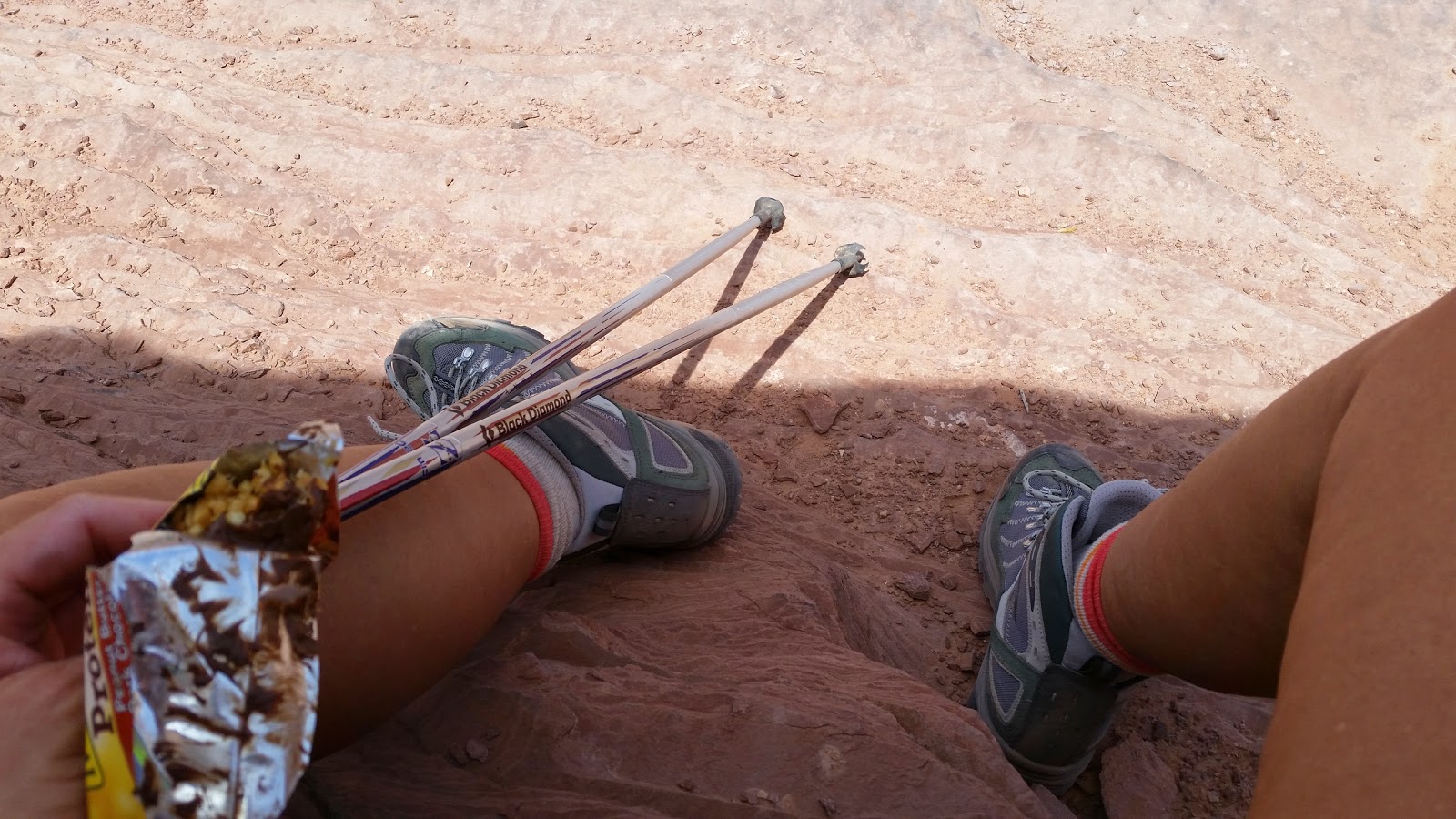
| Trying for a slot canyon selfie |


The slot
canyons were beautiful. I have hiked some before – last year in Escalante, not
too far from Buckskin Gulch, I hike through two canyons. They too were
wonderful. It’s amazing what a beautiful sculptor water is, carving those
lovely curves in the multi-colored rock, and then combine that with the way the
sun lights them as it passes over the narrow gap at the top and the effect is
stunning. I stopped over and over to take pictures, and still it’s hard to
really capture the beauty. These slot canyons can be deadly though – that water
that sculpted the designs could sweep a hiker off her feet, dashing her against
the walls and drowning her in minutes. A person never wants to be caught in a
slot canyon in the rain.

 As I was
finishing the hike, I ran into two couples whom I advised when they had
questions about the trail and the hike. It was kind of cool to be the one who
could give the answers instead of only having questions. I guess I am getting
some experience under my belt now. Or should I say under my boots.
As I was
finishing the hike, I ran into two couples whom I advised when they had
questions about the trail and the hike. It was kind of cool to be the one who
could give the answers instead of only having questions. I guess I am getting
some experience under my belt now. Or should I say under my boots. 
I found a
campsite in Kanab early and showered right away. It felt good to be clean and
in town for a night. I also treated myself to Mexican food for dinner, which
was wonderful, and planned on my favorite Mexican food restaurant for breakfast
the next morning. I felt like I was living a life of leisure - I didn’t have to
cook and when I got back to the campsite, I had WiFi and full cell reception.
But I noticed the nights are a lot hotter in town than they are out of town; I
suppose all that asphalt and concrete brings the temperature up.

I love this
part of the world, and I feel at home here. The days are hot, the hikes
exhausting, and the sun relentless, but the beauty and energy of the landscape
always calls to me. I am a little sad to be moving on, but I am grateful for
the time I’ve been able to spend here.