Thursday, June 5, 2014

Moab - Hiking, Flying, and Jumping


Back on the slick rock
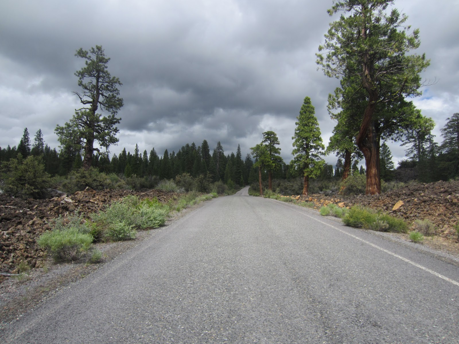
June 2 – I made my first hike of the trip this morning. The Moab area has such a wealth of choices, from Canyonlands to Arches and everywhere in between. I decided I’d hike a trail I read about in Backpacker called the Moab Rim Trail. It promised a steep ascent with a wonderful payoff, and it was right.

I got a little later start than I wanted to – I had to stop and ask a cop where the trail head was. I had a map, but it was a topographical map and it didn’t show the name of the road. I knew where it ran, but I didn’t know how to access it. Once I had that figured out, it was about 9 a.m. when I arrived, which is late to begin a hike in the dry, hot Southwest.

As I was putting on my pack and setting my GPS, a couple came down from the hike. They were locals, and they said this was one of their choices for a morning walk with the dog. After I suffered a quick bout of envy, we talked a little about the hike, about living in Moab, and hiking with dogs.  As they drove off, I began the hike.

The Colorado, straining at its banks
Every year, when I first hike on slickrock, I’m surprised how unslick it actually is. This was the virgin excursion for my new boots, so I was eager to see how they performed, which they did superbly. Not only do they grip the rock well, but also they are very comfortable – more so than any boot I’ve tried. And again, they look outdoorsily hip.

Climbing the initial ascent was rigorous, but most of the route was shaded and I felt fresh and alive. I could look out over the Colorado River as I climbed, and it felt so good to be back on a challenging, beautiful trail here in red rock country. When I was near the top, I ran into a hiker coming down. He was another local, and we visited for quite a while as he gave me advice on hikes to take and places to see. I’ve filed it all away, and I hope to use some of his suggestions. But the conversation delayed me another 30 minutes, and I knew the day was getting hotter by the minute. We said our goodbyes, and I soon climbed out of the shade and into the full force of the southern Utah sun. In not too long, though, I came to the reason for the trail’s name – a grand view of Moab and Arches National Park.

(My camera did this automatically - I took a number of quick pictures, and it stitched them together. WTH? I love this Galaxy s5!)
I soaked in the view, climbing out as far as I could on the jutting rocks. I decided to hike about another mile and a half before heading back to the car, making the full hike about five miles. The trail took me away from the rim and back toward the rising and falling landscape. The trail led up some slick rock and down through some washes, and it offered some spectacular views of Canyonlands. The beauty of this area defies words. I can’t begin to communicate the feeling of connection and attachment I have to these lands. They’re brutal and unforgiving, harsh and rough, but the contours and colors of the landscape – the reds and oranges, juxstaposed with creams and grays – is breathtaking. Every step leads to a different view, a new combination. And this time of year the land is not overly stingy with her greenery, and the wild flowers are sprinkled more liberally 
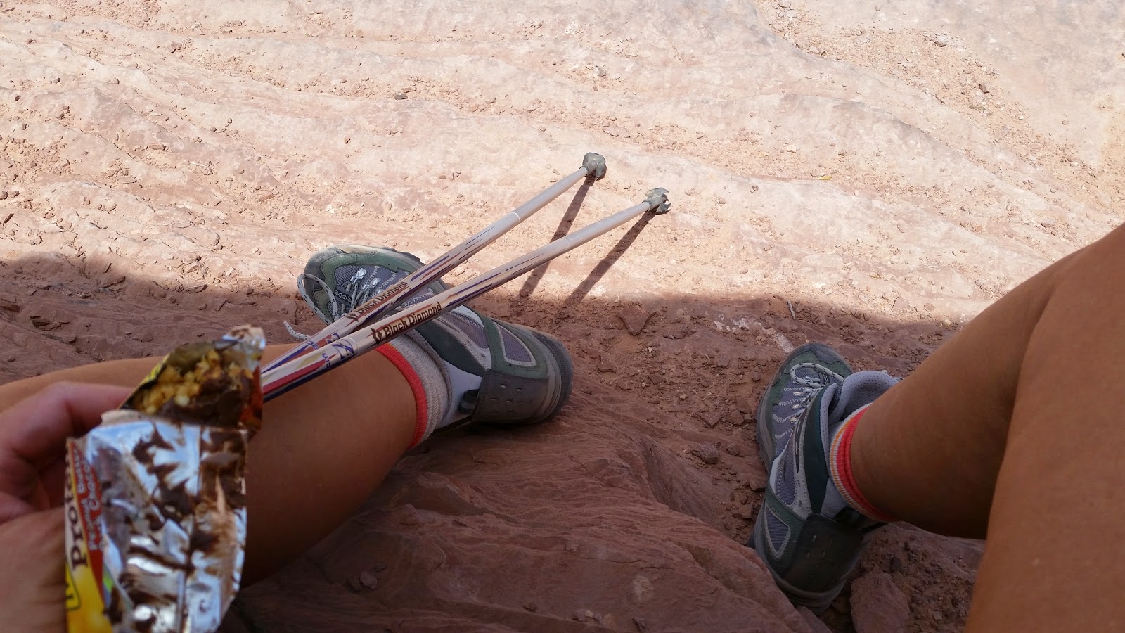
than later in the year.

I turned around right at two and a half miles, and retraced my steps. The day was getting hotter, and I was getting tired. I have a tendency, when I get fatigued hiking, to push harder rather than to rest. This is not really a good plan, and I’m trying to break that habit. I kept thinking I’d stop for an energy bar and some rest when I hit some shade, but that didn’t happen until I was more than four miles into the hike. When I finally did find some shade I could sit in – what had been shaded for the climb up was now in full sun – I remembered how much it helps to take those few minutes to rest. I had renewed energy to finish the hike, and was back at the car before long.

Appreciating my new boots
I returned to town, showered, and drove around the area a little. As I was heading back to my campsite, I passed a billboard for Skydive Moab. Before thinking about it too much, I called the number. It turned out they had a special of $25 off a jump and had an opening the next morning at 7 a.m. The voice on the phone gave me a few hours to decide, and I texted the kids and asked their opinion.

Me: I’m thinking about skydiving tomorrow. What do you think?
Emilie: Do it!
Anna: Jealous!
Nick: Dope!

I took this as encouragement, called back, and made the reservation. I was going to jump out of a perfectly good airplane in the morning.

Ready to go!
June 3 – I rose early, broke camp, and allowed myself time to grab a cup of coffee before heading to the airport for my appointment to jump. I had initially been worried about hurting my ankle or feet before the big hike at the end of the month, but realized I could turn my ankle on one of the hikes I’m doing just as easily – maybe even more easily – than hurting myself skydiving.
 
            I met Dani, the woman who was jumping at the same time, in the parking lot, and we walked in together. She was from Arkansas, and her husband was with her. He was not jumping. We approached the hangar, and it had an airplane parked in the middle of it, some office equipment on one side of the plane and a couple dirty sofas with a television on the other side.

            We began our training by filling out a four-page form that basically said we could die and we wouldn’t sue anyone. Then we watched a video that said we could die and we couldn’t sue anyone. The instructor, Kevin, ended up being my jumping partner. He was probably in his late 20s or early 30s, was tattooed liberally, and was hipsterish in an outdoorsy adventure kind of way. He was the older, more mature appearing of the two instructors.

            We quickly donned our harnesses with help from Kevin, after being warned by the video that we “may be touched in ways that at other times might be considered inappropriate, but was necessary to secure our harnesses,” and were instructed where to stand, how to exit the plane, and what to do when we began our fall: “Look back as we do the free fall flip to see the plane flying away – it’s awesome!”

Sticking the landing
            It all happened so fast. Even though we flew for about 20 minutes over Canyonlands, I felt I had no time to get nervous. I’m not one to worry a lot about something like that until I’m actually beginning it, and it happened so fast, the first time I felt nervous was when they opened the door and a blast of cold air hit me. Dani jumped first, and I didn’t even have time to watch her as we moved quickly into position and were out the door. Hovering a few seconds with my feet on a little ledge below the wings, my guide pushed us out into the sky.

            The free fall was amazing. I wore goggles to protect my eyes as the wind hit us at 120 miles per hour. But it was spectacular. I never felt afraid, I never felt anxious. I just wish it could have lasted longer. Paradoxically, we seemed suspended in the air for a long time before Kevin pulled the chute and we were jerked back into a gentle float. He let me guide the chute a few times, turning us one way then the other, before he took control back. Soon the landing spot was in front of us, and the ground was approaching. He called for me to lift my feet, and then as soon as his hit the ground he said to put mine down too, and we jog-walked into the landing.

Time is completely non-existent when you jump. It seems to last forever and it seems to happen in a split second.  The whole experience was phenomenal, and I’d do it again in a heartbeat. Before I jumped, Deb Heaton reminded me to keep my eyes open, and to be honest, I don’t remember if I did or not. I do remember getting a look at the bottom of the plane when my instructor reminded me, but when we actually launched off the platform, I don’t remember. 
Valley of the Gods

            These guys, all young and a bit rumpled, were professional and very good at what they did. I could have let appearances put me off, but that would have only detracted from the experience. As it was, I loved every bit of it and was so glad I took the leap. (Nice pun, no?)

            The jump took me out of the mood for the short hike I had planned for the morning, so instead I stopped at the Moab Diner and tried an omelet smothered with their famous green chile. I now understand why it’s famous – the omelet was spectacular and a fitting close to my time in Moab this year.

Monument Valley
            I drove most of the rest of the day, taking the drive through The Valley of the Gods and Monument Valley, enjoying these monoliths rising from the desert floor. After some consideration of camping near Monument Valley, I decided to drive on to the Glen Canyon Recreation Area to camp and find some hikes the next day. I chose to camp at the main campground on Lake Powell, giving up seclusion for good showers, real restrooms with running water, cell service and Wi-Fi, and a breeze off the lake. I could have swum or dined at the yacht club, but I’ll only take this pampering stuff so far.

View from my campsite at Wahweap Bay on Lake Powell
            So I’m sitting here, with my feet warmed by the campfire and a soft breeze blowing across the lake and the slick rock, enjoying the evening. This day I’ve checked another main item off my bucket list, and for that – and for so many other things – I’m grateful.


Nebraska, Colorado, and Utah


Rather than posting daily, I’ll probably post every few days. I think everyone gets blog fatigue – I know I do! So here are a few highlights from the first few days:

Cattle cooling themselves near Niobrara - 94 degrees
May 30 – I drove across the top of Nebraska, staying on Highway 12 till I moved south about halfway across the state. I stopped in the little town of Spencer, Nebraska, to fill my soda and use the restroom. It was 95 degrees out, and there were about six damp blonde girls, wet pony tails “hanging their pencil leads” down their backs, purchasing a variety of candy.
Making conversation, I said to one of them, “You’ve been at the pool. It’s a good day for it.”
She answered, in her very serious 8-year-old voice, “Yes. And we’re going back. The concession stand isn’t open yet.”
Ah, of course.
On their way back to the pool
I smiled as I backed out of the lot, watching the slew of them walking back to the pool, sucking on their various selections. THAT is what summer is all about.

I realized, as I pondered the joy that exchange brought me, how we glorify busy. We Americans often demean the French for their long vacations and short work weeks, but I think they have something there. Our lives have become so busy – it’s all about how much money we make or how successful we are. And we’ve all left behind that kid, out for summer, loving life and taking it just as it is, strolling to and from the pool without an agenda for improvement or goal in mind. I guess that’s what my summers have become – and I’m quite grateful for that.


May 31 – I awoke to the sound of rain on my tent after finding a small campground just outside Long Pine, NE, where I’d pitched my tent. There had been a chance for thunderstorms, but they had passed me by, leaving only a light rain that came and went during the night and the morning. I broke camp sporadically, dodging rain and trying to keep dry. Back on the road, I looked for the most interesting path. I passed cattle grazing in fields – one herd was all white, and the juxtaposition of those tiny white calves and big cows against the new, fresh green of late spring fields, was lovely. The smell of hay and grass and earth and rain reminded me of the way a farmer-lover I’d once had smelled when we lay together. It was a lovely drive.

I visited Carhenge, a place I’d wanted to see for a while, and strolled around some farmer’s idea of car-art. What a wonderful thing the human imagination is.
 
I drove on, making my way out of Nebraska, and the drive was filled with trains hauling coal and turtles crossing the road. As I drove into Colorado, the fields were heavily spotted with oil and gas wells. I had no idea so much drilling was going on in that part of the state – it was the main focal point of much of the landscape. Those wells, along with cattle feedlots that ran for miles, created an impression of northeastern Colorado that is a sad one where profit trumps common sense and the dignity of the land. But more on that later.

The biggest hurdle of the night was trying to find a place to sleep. I visited a few campsites north of Denver, but they were full. Calling around, all the others I had numbers for were full too. I decided to head south through Denver and hit an REI store, then resume my hunt. I did score at REI – I finally found the right boots. They’re Asolo brand hiking boots, and were a bit spendy. But I was able to trade in the ones I bought last year, making the difference I had to come up with quite manageable. They look different from a traditional boot, with dark green suede uppers and striped laces, and I told the hikerish/hipsterish check-out guy I had some reservations about the look of them. He replied, “They’re totally like European mountaineering boots.” So, okay, I’m good with that.

Back on the road, I headed south again, resuming my hunt for lodging and found nothing. It was dark by now, and driving unfamiliar mountain roads in the dark is not my favorite thing to do. After wandering through some back highways, I returned to I-70 and stopped at a Super 8. Not the classiest or newest hotel, it was clean and reasonable, and I was tired. (Note to self: never wait to find a campsite after dark near a metropolis.)
Grazing along the interstate when I left my hotel

June 1 – I rose and began meandering toward Moab. I decided to take a scenic byway, leaving the interstate and dipping down through Leadville and Aspen. The drive was surprising in many ways. Again, from the interstate to Leadville, the landscape was often marked with oil and gas wells and mining operations. Mountains were sheered off and terraced, and large, concrete structures dotted the land. I noticed, too, that almost all of the lakes I passed showed evidence of the ongoing drought with exposed lakebed and often brackish water. Juxtaposed with the low lake levels were some of the highest, fastest running rivers I’ve seen on my drives through Colorado. What a strange time for our earth.

Lots of snow at the pass
But the drive was a good choice. Rounding the southern-most dip of the drive, I started up toward Independence Pass. Signs warned that any vehicles more than 35 feet long were prohibited, would get stuck, hold up traffic, and be fined heavily. Clearly, the Colorado powers that be wanted to leave no room for doubt. Because the road was so narrow in places and the turns so sharp with steep drop-offs, no semis or huge travel trailers could make the drive. I climbed and climbed, and the drive became snowier and snowier. Soon, I was navigating alongside 10-foot walls of snow, cut to follow the road, at more than 11,000 feet. I began to feel dizzy, seeing a few little floaters, and feeling sick to my stomach. I realized I’d been drinking only Diet Coke all day, and I was probably getting dehydrated. I pulled over, opened my water jug, and guzzled the whole thing. I also ate some nuts and licorice. I began to feel better almost immediately, noting that I needed to be sure to drink water regularly and Diet Coke occasionally, not the reverse. Good thing when I hike I only have water.

After coming down from the pass, I returned to the interstate, and continued to Moab. I love that point, just after passing through Grand Junction, Colorado, where I see the LaSalle Mountains off to my left. I know then that I’m close. I stopped to take a picture of the Utah sign, and visited with a young couple from Wisconsin on a road trip. They too were headed first to Moab and then California, with a stop in Las Vegas. Nice kids, and we ended up running into each other in Moab the next day.

Colorado River is overflowing its banks
I intended to stay at a campground where I’ve stayed twice before – once with Deb and Jesse when we made the trip to hike the Grand Canyon, and then again last year. It’s a lovely shaded little primitive BLM campground right on the Colorado River. Unfortunately, the campsites were already taken, but I found a place just one campground down. It doesn’t have the same full shade, but it did have evening shade and it’s right on the river also. So I set up camp, ran to town for essentials, and bedded down for the night.

It’s been a good trip so far – I’m happy and content, even when I couldn’t find a place to stay. If I can stay centered, I can’t imagine I’ll have anything to complain about. Finding things to complain about seems so subjective anyway – either I do or I don’t find fault in the world around me, regardless of the circumstances. Being away from those who find it necessary to find fault (99% of the people in our world) makes it easier to leave that all behind and just experience with mindfulness and clarity. So far, I’m remembering to let judgment go – of others, of myself, of situations. So I’m going with that right now.


Tuesday, June 3, 2014

One more time . . .


            Well, I’m off again for a summer adventure. This year, hopefully, I’ll complete the most difficult hike so far – the John Muir Trail. I’m also planning to be gone for 11 weeks – the longest I’ve ever been away from those I love and familiar surroundings. Since I live alone, you wouldn’t think it would be that difficult, but I found out last summer just how hard it is to be away from all you know.

            Last year, I was naïve in many ways. I had no idea how lonely it can get on the road. I have traveled alone before, for as long as 30 days, so I expected I would miss my kids. But I didn’t realize how many times, when they had something come up in their own lives, I missed being able to be there for them in person, to be able to drive an hour or so down the interstate and give them a hug or a reassuring word. I know how much physical comfort means to receive, but I had no idea how much it means to be able to give it. 

I also missed intimacy. While Facebook and the blog help me feel connected while I’m on the road, and random connections with strangers fill some of those empty places, having no one with whom to share the intimacies that come from sharing new experiences can sometimes create a palpable, deep loneliness. I have no doubt I’ll experience those bouts of loneliness along the way, but I seem somehow more prepared just knowing to expect them.

I was naïve in other ways too. I realize that last year I had expectations of some grand realization or life-changing event. I approached each day, each new experience, as if hidden within it was a fortune cookie promise actualized., and by showing up, I’d cracked the cookie open, its riches eager to shower upon me. Of course, these were unreal expectations. Sure, I had some amazing, unforgettable experiences, and I was changed by the events of the summer, but none of them were that earth-shattering, paradigm-shifting, mind-blowing experience I’d imagined. And so I had a nagging sense of disappointment much of the time.

Finally, last year the trip was handicapped by circumstance and timing. I was sorting through the fresh loss of a man I dearly loved and whom I expected to be always in my life in one form or another. The various stages of grief tag-teamed my psyche most of the summer, and I spent a lot of time aching from that raw wound of loss.

Not only was I emotionally wounded last year, but also I suffered a physical injury to my foot. This injury crippled me and forced me to abort the biggest event of the summer, the 220-mile John Muir Trail from Yosemite to Mt. Whitney. The disappointment was devastating, and making the decision to pull out at the last minute was one of the hardest things I’ve ever had to do. Even though I knew then and I know now it was the right decision, I felt like a quitter and a failure. That feeling followed me home where I lay around the house for the second half of the summer, nursing my wounds.

I am blessed to have another chance at that hike and the summer of adventure. This year is a new opportunity, even though I’m redoing some of the events I’d planned last year. I am hiking the JMT this summer with a foot that is about 95 percent healthy. I’m in a stronger place emotionally and spiritually than I was last summer, and, maybe more than anything, I have lost the naiveté from last year. I know to expect the loneliness. I know not to expect an earth-shattering experience. I am more fully awake to the present moment, remembering most of the time to let go of expectation, judgment, and desire. I feel more able to take whatever comes without having to label it as a “good” experience or a “bad” experience, and simply take it in.

Who knows what the summer will bring. But I know one thing: It will be what it is. And I’m ready for just that. Nothing more and nothing less.

Monday, July 1, 2013

Days 38 and 39 – June 26 and 27 California Lava Beds and Volcanic Peaks


(Because of time, I'm simply posting all the pictures - and there are a lot - at the end of the post. I'll arrange them appropriately when I'm back from the John Muir Trail.)

I woke up to the sound of rain. Ah, something new and different. Well, it was different in that it quit before I got up and I haven’t seen any since thankfully. I also woke up to a calm lake with herons roosting on the far side. Occasionally one would rise and glide above the water, only to find a little more desirable place to settle into preening and whatever else herons do. It was sunny by the time I broke camp, and I was eager to get on the road to California

After looking at the map, I decided to follow Eric’s advice and take the less populated road.  I noticed one route I could take ran by Lava Beds National Monument, so I programmed the GPS and headed into California.

I don’t know what it is about northern California, and maybe the feeling was enhanced by the strengthening sunshine after so many days of clouds and rain, but I almost always feel as if I’m coming home when I’m there. And this day was no different. It seemed I could breathe more deeply and a sense of ease came over me. I was driving through smallish mountains formed by volcanic activity, and as I approached Lava Beds, I began to see more and more evidence of volcanic activity. Beds of black porous rock lined the highway, and the mountains became more distinctly volcanic, even to a layperson’s eye like mine.

Lava Beds National Monument was such an unexpected pleasure. I kept stopping the car to shoot pictures, but I still was unable to capture the magnificence of the landscape. When I pulled up to the entrance gate, I visited for a few minutes with the ranger there, asking what I shouldn’t miss. Wonderfully friendly and helpful, she said I should hike to the fire tower at Schonchin Butte and suggested I hike into Skull Cave, the deepest cave open to the public at the time.

Thanking her, I headed for the butte. I first saw the fire tower atop the butte, and then I saw the turn off. She had warned that it was a short but steep hike, climbing 500 feet in .7 miles. I figured it would be good practice for the John Muir (which climbs 5000 feet in the first 13 miles) and was looking forward to the hike and stretching my legs again after a few days primarily in the car.

As I was climbing to the tower, the smell of the cedar trees was strong and the air crisp. I was overcome with pleasure as I realized, once again, that this is why I hike. The pleasure and joy I get from the immersion in the purity of all the earth has to offer our five senses cannot be overstated. It feeds my soul as little else does. When I’m tuned into taking it in, there’s a feeling of oneness and belonging I feel nowhere else.

As I rounded the side of the butte, coming around to the north side, the wind hit me, and it strengthened the rest of the way up. The departing storm system was to the north, and the sky was dark there. In places I could still see the rain coming down. I wondered if I should have brought a jacket (“a three-hour tour . . .”) and my backpack. But I arrived at the top without mishap, and the ranger stationed there greeted me warmly. It turned out his wife was the ranger at the entrance, and he was just as friendly and helpful as she had been. I was the only visitor there, and we had a nice chat. I then made the trip around the building, taking in the entire surrounding landscape, seeing the evidence of spent volcanos and the contours and layers of the land.

The hike back down was quick, and I made for Skull Cave. Arriving there, I had a strong feeling of foreboding.  The idea of a cave seemed eerie and more than a little frightening, and the topic of bats had been talked about by both rangers. The yawning opening of Skull cave was not tremendously welcoming, but the path was well-constructed, and there was a man with his two kids going in just behind me. I couldn’t exactly chicken out when a 10-year-old girl was eagerly anticipating exploring the cave. (The younger boy did end up going back to the car to sit with his mother after walking a few feet into the swallowing darkness.)

The cave is an ice cave, meaning the floor is made of ice and rock. This is an important source of water for the animals of the region, and the park management had actually blocked off the floor to protect the ice from foot traffic. To get to the lowest level accessible, I had to descend a number of very steep metal staircases. I thought once again what good fortune it is that I’m over my fear of heights. I could have never made that descent and subsequent ascent if I were still acrophobic.  My little headlight and keychain MagLight were no match for the deep darkness of the bottom of the cave, so I saw very little outside a small area. I didn’t linger long, and I doubt I’ll do much spelunking in the future, but I was very glad to have seen the cave – and no bats.

I drove south out of the park, taking the volcanic parkway scenic drive. The road was very rough and narrow, but again, the views were wonderful. It was really interesting to see so much of the land altered by volcanic activity. The drive took me down to Lassen Volcanic National Park where Lassen Peak, the southernmost high peak of the Cascade Mountain Range, rises. Eric had explained to me that the Cascades, which end around Lassen Peak, are all volcanic, and that the Sierra Nevada, which begin their run south near the same spot, are granite and upward thrust mountains. (Forgive me for not knowing the proper term here).

Lassen Peak rises out of the surrounding mountains pretty obviously, and I was surprised about the amount of snow on it. I decided to camp there in the park’s campground, knowing I could shower there and have running water. I settled down for the night, built a rather weak fire – everything was still damp – and retired to my tent fairly early. I didn’t sleep well though – it was cold and damp and I was feeling lonely.

It seems I feel more lonely when I stay at large campgrounds where everyone around me is camping with family and loved ones. I feel rather isolated as I can’t help but observe the interaction among the campers. I had debated about staying two nights at Lassen, but I decided to move on the next day, after maybe a short hike and driving through the park. I yearned for one of my inexpensive, primitive campgrounds.

The next morning, after a much-needed shower, I began driving the one road through the park. I had planned on maybe hiking King’s Falls Creek, but for some reason, it just didn’t feel like the hike for me. Eric had suggested I hike to the top of Lassen Peak at just over 10,000 feet, but the ranger at Lava Beds told me they only allow hikers to summit the peak a few days of the month in June and July, and I wasn’t there one of those days. So I had given up on that idea, and was just basically looking for what looked like a good hike.

When I got to the parking area for Lassen Peak, I pulled in to check it out. After reading the information posted, it was clear that although I couldn’t hike to the peak, I could hike up a little over a mile toward the peak. The trail was closed after 1.3 miles, but I could hike to there. It was a steep climb, but I was excited to do it.

Lassen Peak, by the way, is a volcano that blew in the early 1900s. It blew twice, a few days apart. The destruction zone is large, and the evidence of the volcano’s power is still evident.

The trail led up steeply, and then began making switchbacks as it climbed. There was a good deal of snow on the mountain, and some of the trail was still snow-covered. There were also some downed trees that I had to navigate around, but it was still an invigorating hike.  I was stopped about a mile up, talking with a couple from southern California, when park workers began passing us, carrying all sorts of surveying and other equipment. They were doing some extensive trail maintenance and had been for a few days they said.

About the third group that passed us stopped just as they went around. One of the crew exclaimed as he sat on a rock outcropping and pulled off his boot. Blood dripped from the top of it, and his sock was saturated. He dumped blood out of the boot, and it continued to drip from his sock. The other crew member with him began to administer first aid. It was horrific. The injured man said he’d had a blister the day before, but it didn’t seem too bad. If this was a blister that was neglected and ignored, it certainly has driven home the importance of not doing so.

I asked if I could do anything, and the one asked if I would go back down the mountain and tell the crew members who were on their way up. They were bringing up a motorized wagon and would be able to help the man down - he wasn’t coming down without assistance. So I cut the hike short, but I figured helping with the situation was more important than hiking that last third of a mile to the turnaround point.

I still don’t know what happened or how long it took the man to get down, but I’ve thought a lot about him and his bleeding foot since leaving Lassen Peak.

I left Lassen Park and headed east toward the Sierra Nevada. I always enjoy driving 395, the highway that cuts across northeastern California and then down through Reno and Lake Tahoe, and finally running along the east side of the Sierra Nevada. The first part of the drive, as it cuts mainly east, is wide open high desert. I can’t drive that portion without thinking of the time Jesse and I came across there late at night and stopped for a while to look at the night sky, arguing over whether the star near the moon was Jupiter or not. After checking Google Sky, I was proved correct – it was Jupiter. But the night was so dark and the stars were so bright, it didn’t matter who was right or who was wrong. What mattered was the brilliance of a sky full of stars and little else in the way of light.

But this drive was in daylight, and I admired the landscape as it changed along the way. I found Lover’s Leap campground southwest of Tahoe in a little burg named Strawberry.  I settled into the primitive campground and thought about the upcoming hike through the Sierras, feeling anxious and worried about my foot. The undertaking seemed unmanageable that night – all of my doubts and fears wore large and frightening shapes, and I had another night of little sleep. I hoped I would have some direction the next day, and finally fell into a restless sleep.